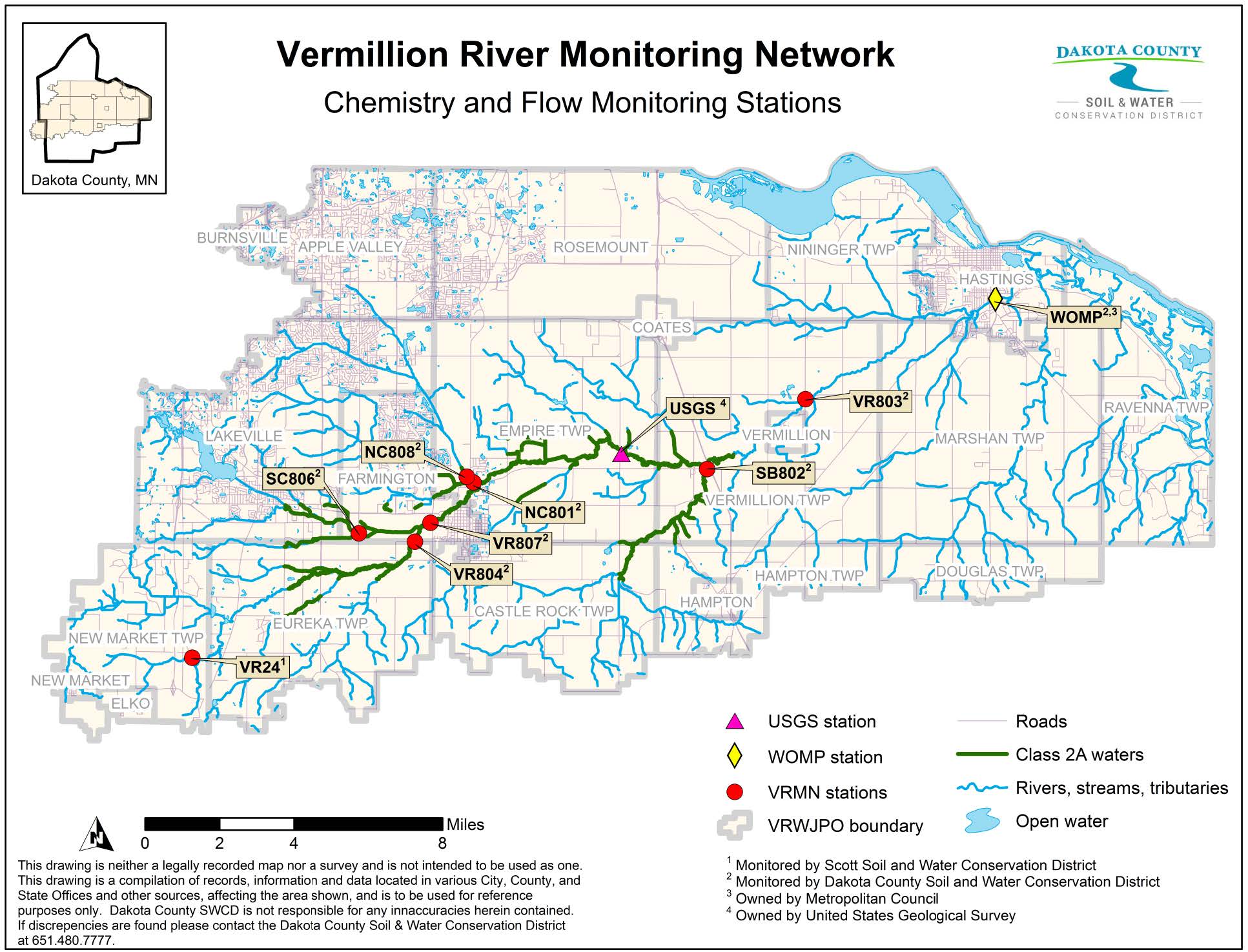
Monitoring
Dakota County and Scott Soil and Water Conservation Districts (SWCDs) sample water at multiple sites, maintain data, and upload information to statewide databases from the Vermillion River Monitoring Network. Annual reports document the river’s condition and trends.
SWCD staff collect water samples to monitor levels of nitrate, total phosphorus, total suspended solids (TSS), E. coli bacteria, dissolved oxygen, temperature, and electrical conductivity. Routine monitoring takes place throughout the year, primarily between April and November. Staff also monitor during runoff events, such as snowmelt or heavy rains.
Real-time stage and flow data is available from the U.S. Geological Survey (USGS). More locations with periodic updates, including water temperature, can be found through the Minnesota Department of Natural Resources’s Cooperative Stream Gaging map.
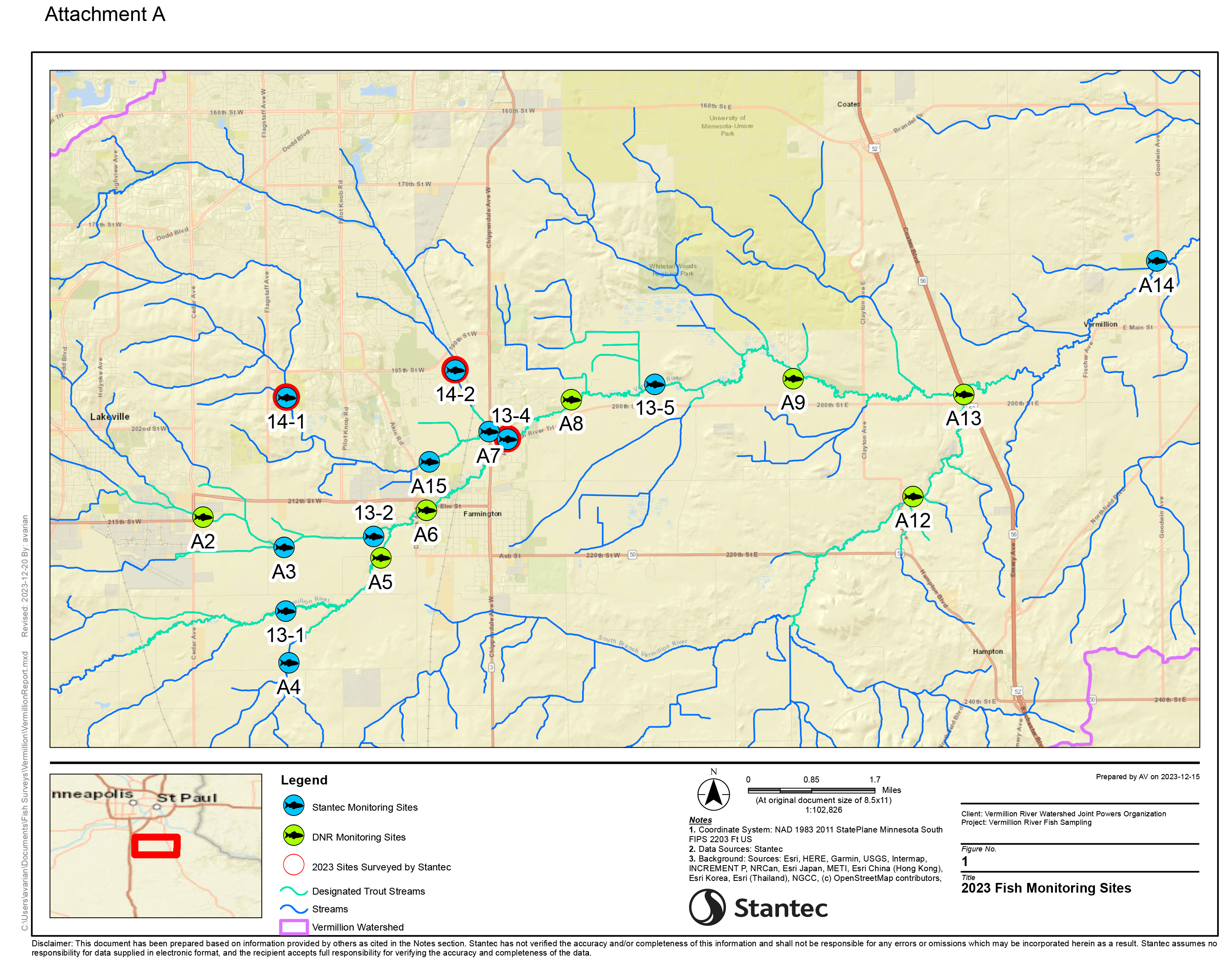
In addition to the above water quality and quantity parameters, VRWJPO follows a biomonitoring plan to glean another sense of the watershed’s health. Fourteen sites in the watershed are monitored on a rotating annual basis for habitat health, fish, and macroinvertebrates. Biomonitoring results are measured using the Minnesota Pollution Control Agency’s Stream Habitat Assessment protocol and indices of biological integrity.
